
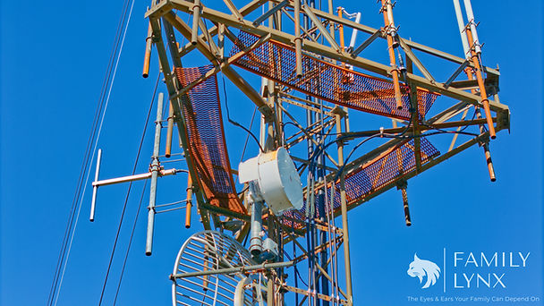
Infrastructure Inspection & Visual Assessment
On-call visual inspection services for infrastructure assets — delivering structured imagery and clear, observational condition summaries to support municipal and operator decision-making.


Why Call Us?
When infrastructure matters, clarity matters. Family Lynx provides structured visual documentation of critical assets—capturing real-world conditions in a way that supports informed decisions, strengthens oversight, and reduces unnecessary site visits.
From towers and municipal structures to dams, erosion zones, and remote facilities, each engagement is built around disciplined observation, organized imagery, and clear, reference-ready deliverables. Our field-ready approach allows us to operate in challenging environments while maintaining consistency, reliability, and confidentiality.
When access becomes difficult, capability matters. With off-road deployment readiness and mobile satellite connectivity, we can reach remote or compromised locations and relay information in real-time—uploading imagery, sharing live conditions, and communicating directly through voice, text, or video when it matters most.
Beyond ground-level capture, aerial documentation adds a critical layer of understanding. Orbital perspectives reveal how assets relate to their surroundings—providing spatial context, access visibility, and a clearer view of the full operational environment. This added depth allows stakeholders to better interpret conditions, communicate findings, and maintain awareness without being physically present.
If you need clear, reliable visibility into the assets you’re responsible for, we’re ready to step in. Submit a request below to start the conversation and schedule a consultation.
The Details
Infrastructure Inspection & Visual Assessment is built around structured visual documentation methods selected based on site conditions, safety, and access. Primary capture includes drone-based aerial imagery (when permitted), ground-level photography for detailed and access-limited areas, and supplemental 360° capture where additional context is beneficial. Live streaming capability is available when real-time visibility is needed, allowing stakeholders to observe conditions as they develop. Each deployment is approached with flexibility, ensuring the most effective method is used to document visible conditions without compromising safety or compliance.
Every engagement delivers a standardized, professional package designed for clarity and usability:
-
Organized, numbered image set with location reference
-
1–2 page observational summary with image-linked notes
-
Clear disclaimer language outlining observational scope (no engineering, grading, or certification)
Infrastructure deployments are structured around time-based field execution:
-
Half-Day Deployment (up to 4 hours): $1,050
-
Full-Day Deployment (up to 8 hours): $2,100
-
Additional time: $195/hour
Travel and deployment are built into the service model. The first 60 miles (one-way) are included. Travel beyond this range is billed at $1 per mile (round trip). Extended travel, remote access coordination, or overnight requirements are quoted based on scope.